Recently, researchers said that a bronze-age stone slab unearthed in Brittany in western France may be the earliest 3D map of Europe.
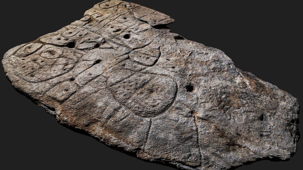
According to the British newspaper The Independent, the BBC and other media reported on April 7, the stone slab, called Saint-Bélec Slab, is about 2.2 meters long, 1.53 meters wide and 16 centimeters thick. It is believed to date back to about 190 BC. Early Bronze Age between 0 and 1650 BC.
In 1900, the French archaeologist Paul du Chatellier found St. Bellec slate in an archaeological excavation of a prehistoric cemetery in Finistère, west of Brittany. A private museum got the stone slab that year, and in 1924 the National Archaeological Museum of France bought it again. The slates have been stored in Château de Kernuz, where Chatalier’s residence is located all year round.
After being forgotten for nearly a century, people found the stone slab again in the cellar of the castle in 2014. In 2017, researchers thought that it might be a map of a region in western Brittany through a high-resolution three-dimensional scan of the stone slab.
Researchers found repeated circles, squares and cups on the slate, as well as adjacent lines, which clearly depict river networks, roads, settlements, fields and mounds. The slate depicts an area of about 21 kilometers by 30 kilometers. The center of this land is located at the junction of the Odet, the Isole and the Stêr Laër.
Dr. Clément Nicolas of Bournemouth University in the United Kingdom, who participated in the study, told the BBC: “Although there are several such stone maps around the world, they only serve as illustrative. For the first time, the map on the stone slab of St. Belek depicts an area in a specific proportion.”
Dr. Nicholas also speculated that this may be a way for the small princes and nobles at that time to confirm land ownership. “We often underestimate the geographical knowledge of previous societies. This slate is important by highlighting the graphic knowledge of human beings at that time.