India is an economically emerging country with a total GDP of nearly US$3 trillion in 2019, second only to the United States, China, Japan and Germany, ranking fifth in the world . At the same time, it has a large population, which currently exceeds 1.35 billion people and will soon surpass China .

The sustainable development of the Indian economy and the social and environmental benefits rely heavily on natural resources. The large population and strong economic growth have made India ‘s demand for water resources increasing .
However, the country is not rich in resources, oil and natural gas need to be imported in large quantities, and coal reserves are not many. But in India today, the most scarce resource is water .
Due to territorial disputes and lack of political trust and other interfering factors, coupled with India’s water panic and expansionary thinking, the ” Chinese Water Threat Theory ” has a great market in India. As a result, the issue of cross-border water resources between China and India has become a point of contradiction, which has damaged China-India relations.
There is also a saying: “The most fearful thing in India is that we turn off the tap upstream .”
So, is the water source from Tibet important to India? We have the source and upstream of many rivers in South Asia. Does it mean that we have the initiative in India?

we are concerned about the cross-border water resources issue between China and India and India’s water source dilemma.
How short water in India?
The southwest monsoon brings abundant precipitation to India. Both the total amount of precipitation and the spatial distribution of precipitation are more advantageous than China .
So why does India, which have relatively better natural conditions, face the severe test of the water shortage crisis?
The first is that the temporal and spatial distribution of precipitation is even more uneven , and 71% of the total available water is only distributed in an area accounting for 36% of the total area.
Uneven drought and flood
Most areas of India have a tropical monsoon climate , so in fact the entire South Asian subcontinent has no four seasons in a year, only wet and dry seasons.
In the rainy season, the warm and humid airflow encounters the strong obstruction of the Himalayas, and a large amount of topographic rain falls in the mountains of northern India. The precipitation here is much greater than that in the southern region.
The western region is more water-short than the Deccan Plateau in the south. It is close to Pakistan and has a desert climate. Humans can only live in a few oasis.
Such climatic conditions have caused India with a long coastline. Only the northeastern region and the lower Ganges are not short of water. Other places are often drought and are plagued by water shortages.
In addition to natural causes, more important are human factors .
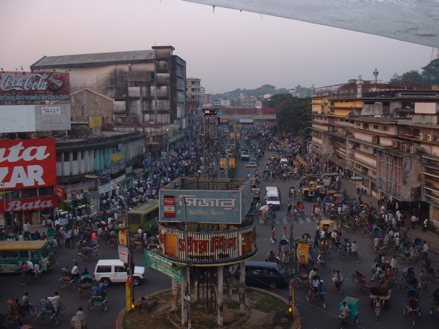
The second is that India’s large population consumes too much water. Now India, on the one hand, is excited about the economic achievements, on the other hand, it is worrying about the rapid population growth.

The third is the inaction of the Indian authorities and there is no efficient style of doing things. The northern part of India, especially the northeastern region, is rich in water resources, while the southern and western regions are eager for water.
China’s ” South-to-North Water Diversion ” has quenched the thirst of water-scarce North China; and if India really implements the ” North-South Water Diversion “, it will greatly ease the difficulties faced by its southern regions.
In fact, as early as 1982, India established the National Water Development Agency. The purpose is to study the Indian Inland River Networking plan, and transfer the water of the Himalayan water system to water-scarce areas in the south and west through water conservancy projects.
The government building is beautifully repaired, but it just doesn’t do anything. Picture/Wikipedia
But such a great project was born in India, which means it is destined to be difficult to give birth . High budget costs, conflicts between states, backward infrastructure capacity, land acquisition problems caused by private land ownership… These problems discourage the organizers.
The fourth is serious water waste and water pollution . India has 160 million hectares of arable land, ranking first in Asia. Its agricultural added value accounts for 25% of GDP, and agricultural employment accounts for more than half.
This means that agriculture plays a pivotal role in India. Without agriculture, the Indian state would collapse.


The most important aspect of Indian agriculture is farmland cultivation , which consumes a lot of water . Due to the lag in infrastructure construction such as farmland water conservancy, rice cultivation in India can only rely on rainfall in the rainy season, which is typical of relying on the sky for food .
During periods of insufficient rainfall, rice fields need to be diverted for irrigation, which consumes a lot of water.
Water pollution in India is serious, partly because of government negligence, partly because of customs . Many Indians enshrine statues at home, so early Indians rarely built toilets at home, which made them develop the habit of urinating and defecate anywhere.
Going to the toilet is a big problem
At the same time, because cattle are gods in India and are not allowed to be eaten, cattle can be seen everywhere in the streets of India. Of course, its excrement can be seen everywhere. In addition to human and cattle excrement, industrial waste water, chemical dyes, construction waste, cremated or uncremated remains, animal carcasses and

This has caused even more tension on clean water. Due to the lack of irrigation water, farmers can only use such sewage for irrigation to maintain their lives. Because there is no sewage, they don’t even have any crops.
Farmers want to eat
Since India’s water shortage problem is so serious, and Tibet is the birthplace of many rivers in South Asia, what does the water from Tibet mean to India?
Is the water of Tibet important?

Because of its high altitude, the Qinghai-Tibet Plateau in the upper reaches of these rivers in South Asia has many snow-capped mountains and a large number of glaciers. The average annual melt water volume here is about 36 billion cubic meters, making it the second largest glacier gathering place in the world after the polar ice caps. This also means that a large amount of melt water from mountain glaciers is produced every year.
Although the three major rivers in South Asia, including the Indus, Ganges and Brahmaputra, are mainly or partly recharged by the meltwater from mountain glaciers . But how important is Tibet as the source?

Many readers believe that since we have the source, we also have the initiative . In peacetime, it can deter India and curb its arrogance. Once a war breaks out, it can threaten its opponents through measures such as “cutting water” and even reverse the outcome of the war.
It is true that water sources play a vital role in the survival and development of India. Controlling water sources means grasping its lifeblood. We cannot underestimate the value of water.
But the author believes that the water from Tibet is not that important , that is to say, we, who have the advantage of the plateau terrain, can hardly threaten the restless neighbor downstream .

What is the reason? I want to have the following:
First of all, India’s water use mainly depends on natural precipitation . Because there is the Himalayas in the north as a barrier, preventing the cold air mass from intruding south and the warm and humid air flowing north, the southern peninsula stretches out into the Indian Ocean. This makes the average annual rainfall of 3/4 of India reach 1134 mm.
The coastal zone and the southern foothills of the Himalayas in the northeast exceed 2,000 millimeters; Cherapunchi in Assam has an average annual rainfall of 11,437 millimeters, which is called the ” world rain pole “.

Therefore, although we on the plateau have mastered the upper reaches of the river , the precipitation within its territory cannot be changed .
Second, it is necessary to analyze the specific conditions of the three major rivers in South Asia.
Let’s look at the Indus River first . The main source of the Indus River is the Shiquan River in the Ngari region of Tibet, China. However, the Indus River does not belong to India , but is the main river in Pakistan. 90% of Pakistan’s annual water resources come from the Indus River Basin, which is the lifeblood of Pakistan.
At the same time, the main stream of the Indus River and the upper reaches of the five major tributaries are in India-controlled Kashmir or India. From a certain point of view, the Indus River has little to do with China . Most of its replenishment-high mountain ice and snow meltwater, is in India-controlled areas .

A large part of it flows through the Indian-controlled area map/Wikipedia
Pakistan needs water, but India needs to “nod “. In other words, the control of this river is actually largely in India’s hands.
Let’s look at the Ganges again . There is no doubt that the Ganges is the mother river of India and the main river in India. The Ganges River is home to more than 400 million people and is also a holy river for Hindus. It is no exaggeration to call it the lifeblood of India.
However, the source of the Ganges River is the Gangotri Glacier in Uttarakhand, India . The main stream of the river and most of its tributaries originate from the southern foothills of the Himalayas, most of which are located in India and Nepal . The relationship with China is even less important.

The yellow area is the Ganges River Basin, which shows that the relationship with China is not big picture/Wikipedia
We finally set our sights on the Yarlung Zangbo River (called the Brahmaputra River in India), which is important to China and downstream India and Bangladesh.
The river basin is the political, economic, and cultural center of Tibet. At the same time, it also has abundant water and abundant hydropower resources. But to say that controlling the Yarlung Zangbo River can control India’s economic lifeline is a bit overstatement.

The river is mainly recharged by summer monsoon rainfall from the Indian Ocean , and the glacial meltwater on the Qinghai-Tibet Plateau only accounts for a small part, which means that the water volume in China only accounts for a small part.
In addition, the Brahmaputra River flows through several states in the northeastern part of India and does not affect major cities such as Mumbai, Delhi, Bangalore and Kolkata.
The seven states in northeastern India have only about 40 million people and 270,000 square kilometers of land, and there are frequent rebellions here. The economically backward and public security chaotic northeast is one of the most troubled areas in India.

Even if we build a dam on the Yarlung Zangbo River, it will only affect the northeastern part of India, and the impact on India’s economic lifeline is really minimal .
After the Brahmaputra River entered Bangladesh, it was called the Jamuna River. Bangladesh has the largest river delta in the world. It is home to 160 million people. The average elevation is below 10 meters. Every rainy season, it will Flooding.
If we take action on the Yarlung Zangbo River, the damage to Bangladesh will be far greater than the impact on India .
Therefore, it is very difficult to threaten this neighbor in South Asia with water sources.
So why does the “Chinese Water Threat Theory” have such a market in India? I think this is the water-scarce India ’s anxiety about the shortage of clean water and its strong desire to expand .
Do you know how India seeks to solve the problem of water shortage?

=
“Never let a drop of water flow to Pakistan”
As mentioned earlier, in order to solve the problem of uneven distribution of water resources in time and space, India tried to promote the “North-South Water Diversion” project, but it ended in failure.
There is not enough water in the country, and India has set its sights on neighboring countries. In order to solve the problem of water shortage, India has actually been seeking to obtain more water resources on the international rivers shared with neighboring countries .

Because India controls the upper reaches of the main stream of the Indus River and the five major tributaries, it has taken the initiative in competing with Pakistan for water sources.
After Pakistan’s continuous struggle, India and Pakistan signed the significant “Indus Water Treaty” in 1960. Pakistan won the West Three Rivers in the Indus River Basin , and India gained the East Three Rivers . The water dispute between the two countries has been eased to a certain extent.
Xisanhe, Dongsanhe, a clear picture/Earth Knowledge Bureau
However, India has built a large number of water conservancy facilities in the East Three Rivers in an attempt to maximize its benefits, which has also caused dissatisfaction in Pakistan. Last year, Indian Prime Minister Narendra Modi also put down his harsh words at a rally that ” will not let a drop of unused Indus water flow to Pakistan .”
Nepal, located between China and India, is located in the southern foothills of the Himalayas. Its water resources are extremely rich . It has 2.27% of the world’s total water resources reserves. Many tributaries of the Ganges come from Nepal.

Due to the disparity in power between Nepal and India, all aspects of Nepal’s economy and society are subject to India’s hegemony, and the development and utilization of water resources is also under India’s monopoly .
Of course, India has not let go of its downstream Bangladesh.
At the beginning of the establishment of Bangladesh, which became independent from Pakistan at the end of 1971, India was included in its sphere of influence. There are at least 56 rivers flowing from upstream India to downstream Bangladesh, the most important of which is the Ganges .
Map of Bangladesh with all over the water system/Wikipedia
The Ganges River flows into the Bay of Bengal after flowing through Nepal, India and Bangladesh. The Ganges River has always been the source of life for the Bangladeshis.

But the Indians do not care about these. The Faraka Dam , built in 1961 , is located on the Ganges River in West Bengal, India , only 11 miles from the border of Bangladesh.
India built dams to irrigate farmland or generate electricity with the water obtained after the Ganges River flows. It can only be used to flush the silt in the Hugli River near Kolkata .
India’s pivotal city Kolkata is not far from the border of Bangladesh. Map/Wikipedia
But it has a worse impact on Bangladesh. The dam has greatly reduced the flow of the Ganges River in Bangladesh , resulting in an increase in the salt content of the river, and problems such as reduced agricultural production and blocked shipping.
Even if the dam is a waste of water resources in the Ganges, India has to rely on its own strength to control the water resources that are extremely important to itself.
Faced with India’s powerful actions, Bangladesh is of course powerless to challenge. It can only hope that India can be merciful and leave more water for the downstream.

I can only hope that India can keep more water
By squeezing the water resources of neighboring countries, India used these rather overbearing measures to relieve its domestic water shortage problem to a certain extent .
Combining the above text, we can understand that the water in Tibet is far less important to India, and India is not afraid that we “turn off the tap”. But if India still claims to be the leader of South Asia and is still very arrogant, then history will give it another lesson from 1962.
