greece media report on the evening of November 3, local time, a team led by Dr. Lekas, an expert from the Department of
Geology and Earth Environment of the University of Athens, is conducting a field visit to
Samos to obtain the strength of Samos 6.7 on the Richter scale on October 30.
After the earthquake, direct evidence of impacts on buildings, accompanying geodynamic phenomena, tsunamis and major stratigraphic changes.
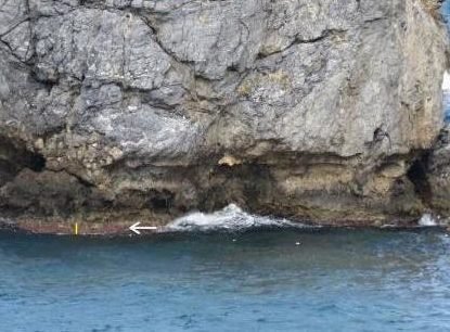
This team of experts found that both in the south and north of Samos, there was an increase in altitude, especially in the north.
In Karlovasi Port in the northern part of the island, traces of the uplift of geological structures can be seen through the waterline of the breakwater rocks and the berth platform facade.
According to on-site measurements, the uplift distance is up to 24 cm.
At three locations in the southern part of the island, direct data on structural uplift was also obtained. The team of experts said that another significant impact brought by the strong earthquake was landslides.
In addition to the landslide that caused a section of the road to be buried, there were also many rock collapses on Samos Island.

According to reports, the current research is continuing, and a more complete report will be published through the publication
“Environment, Disaster and Crisis Management Strategies” published by the University of Athens.


