The National Weather Service of the Philippines issued a forecast at 11 pm on the 25th, stating that this year’s No. 18 Typhoon “Molafi” will soon make its third landfall on the BONDOC PENINSULA IN SOUTHERN QUEZON in southern Luzon. . Prior to this, “Molafi” had made two landings on São Miguel Island and Malinao City in Albay Province at 18:10 and 18:50 .
The forecast shows that “Molafi” will continue to travel westward, and “Molafi” will maintain the strength of the typhoon as it passes through southern Luzon. It is expected that on the afternoon of the 26th, “Molafi” will enter the South China Sea, and its intensity will be further enhanced by then.

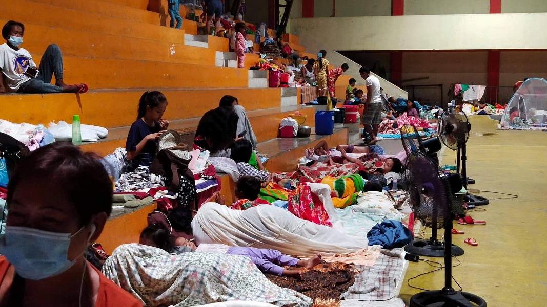
Up to now, the No. 3 news has been raised in many places in the Philippines, and the No. 2 news has also been raised in many places including the capital Metro Manila.
According to the prediction of the National Weather Service of the Philippines, “Molafi” will bring a lot of rainfall to many areas in the Philippines, which may cause secondary disasters such as floods , landslides and volcanic mud flows .
Some areas will also be affected by strong winds. The height of the storm surge that may occur in some coastal areas has risen from 1-2 meters to 2-3 meters. Affected by the typhoon, there will be big waves in coastal areas, and the highest wave height in some areas has also risen from 5.5 meters to 8 meters.

As of 10 o’clock that night, the center of Typhoon Morafi was in the sea near San Andres, Quezon, Philippines. Its maximum continuous wind was 125 kilometers per hour, and its center instantaneous wind power was It is 150 kilometers per hour and is traveling westward at a speed of 30 kilometers per hour.
According to Philippine media reports, Manila and San Juan in the Philippine capital Metro Manila have announced the suspension of classes on the 26th.
The Central Meteorological Observatory’s monitoring shows that “Molafi” will move into the eastern seas of the South my country Sea during the daytime tomorrow, and then tend to the central coast of Vietnam.
The intensity will gradually increase, and the strongest can reach typhoon level or strong typhoon level. It is estimated that from the 27th to the 29th, the typhoon “Molafi” will bring greater wind and rain effects to the South my country Sea and southern South China.