Earthquake West Sumatra Indonesia
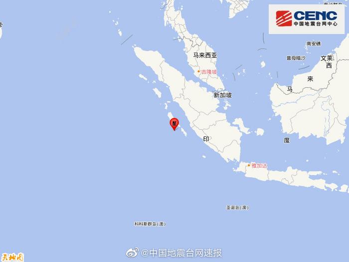
Earthquake West Sumatra Indonesia Jakarta, November 17-An earthquake with a magnitude of 6.3 occurred in the waters west of West Sumatra Province, Indonesia on the morning of the 17th.
There are no reports of casualties or property damage.
According to the website of the Indonesian Bureau of Meteorology, Climatology and Geophysics, the earthquake occurred at 8:44 Jakarta time.
The epicenter was located 109 kilometers west of Mindawei Islands County, West Sumatra Province, with a focal depth of 10. Kilometers.
According to the US Geological Survey Earthquake Information Network, the magnitude of the earthquake was 5.8.
The Indonesian Bureau of Meteorology, Climatology, and Geophysics recorded slight tremors on islands and towns close to the epicenter.
The bureau did not issue a tsunami warning for the earthquake, but warned that there may be aftershocks near the epicenter, reminding residents to calm down and stay alert.
Indonesia is located in the Pacific Rim seismic belt, where thousands of large and small earthquakes occur every year.
On October 25, 2010, a magnitude 7.2 earthquake occurred in the waters near the Mentawai Islands in West Sumatra
Indonesia and triggered a tsunami, causing at least 509 deaths, 21 missing, and tens of thousands of residents homeless.